|
Current
SPC Mesoscale Analysis
CURRENT STORM PREDICTION CENTER PRODUCTS
|
|
| Current Weather Watches |
| This is the current graphic showing any severe thunderstorm and tornado watches which are in
effect over the contiguous United States. Please read about the the purpose of our watches for further information. Details on all valid watches may be found on our Current Convective Watches page. |

|
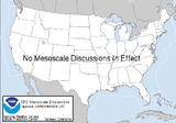
| Current Mesoscale Discussions |
| This is the current graphic showing any mesoscale discussions (MD's) which are in effect over
the contiguous United States. Please read the description of the purpose of our MD's for further information. Details on all valid MD's may be found on our Current Mesoscale Discussions page. |
|
| Current Convective Outlooks |
| This is today's forecast for organized severe thunderstorms over the contiguous United
States. Please read the description of the risk categories for further information. You may find the latest Day 1 Outlook available as well as all Outlooks issued today online. |
Today's Outlook |
 |
| This is tomorrow's forecast for organized severe thunderstorms over the contiguous
United States. Please read the description of the risk categories for further information. The latest Day 2 Outlook is available as well as all Outlooks that have been issued today. |
Tomorrow's Outlook |
 |
| This is the day after tomorrow's (day 3) forecast for organized severe thunderstorms
over the contiguous United States. Please read the description of the risk categories for further information. The latest Day 3 Outlook is available as well as all Outlooks that have been issued today. Note: The 10% and greater probability thunder line is not included
on the Day 3 Outlook. |
Day 3 Outlook |
 |
CURRENT U.S. SEVERE WEATHER WATCHES/WARNINGS
CURRENT U.S. SEVERE WEATHER
WATCHES
 .
CURRENT U.S. RADAR LOOP
CURRENT U.S LIGHTNING STRIKES
 . .
|