Krisch's Official Southeastern North Carolina Weather / U.S. Weather & Severe Weather Website

Home | Severe Weather Software | THE OSEI IMAGE OF THE DAY! | Severe Weather Center 2005 | Hurricane Season 2005 | North Carolina Snow,Ice,Rain, NC Radar | Dopplar 5000 (east-central North Carolina) | Southeastern, United States Snow ,Ice,Rain radar | SE United States Color Water Vapor Satellite | United States Snow,Ice,Rain Radar | United States Radar/Satellite | North Carolina Radar/Satellite | North Carolina Visible Satellite | North Carolina Standard Infrared Satellite | North Carolina Enhanced Infrared Satellite | United States Visible Satellite | United States Infrared Satellite | United States Water Vapor Satellite | United States Enhanced Infrared Satellite | Winter 2005/2006 Season Maps | College's of Atmospheric Sciences and Meteorology

title.jpg

7-Day Forecast

WEDNESDAY  WEDNESDAY 
NIGHT
THURSDAY  THURSDAY 
NIGHT
FRIDAY  FRIDAY 
NIGHT
SATURDAY  SATURDAY
NIGHT
Mostly Sunny
Mostly
Sunny
Chance T-storms
Chance
T-storms
Chance T-storms
Chance
T-storms
Showers T-storms
Showers
T-storms
Chance T-storms
Chance
T-storms
Partly Cloudy
Partly
Cloudy
Partly Cloudy
Partly
Cloudy
Partly Cloudy
Partly
Cloudy
Hi 80°F Lo 57°F Hi 75°F Lo 58°F Hi 72°F Lo 48°F Hi 70°F Lo 48°F

Detailed Forecast

Hazardous weather condition(s):


Hazardous Weather Outlook

Wednesday. Mostly sunny. Highs around 80. South winds 5 to 10 mph.

Wednesday night. Partly cloudy. A chance of showers and thunderstorms after midnight. Lows in the upper 50s. South winds 5 to 10 mph. Chance of rain 30 percent.

Thursday. Partly cloudy with a chance of showers and thunderstorms in the morning. Then mostly cloudy with showers and thunderstorms in the afternoon. Breezy with highs in the mid 70s. South winds 10 to 15 mph. Increasing to 15 to 25 mph in the afternoon.

Thursday night. Showers and thunderstorms. Breezy with lows in the upper 50s. South winds 15 to 25 mph. Decreasing to 10 to 15 mph after midnight.

Friday. Partly cloudy with a chance of showers and thunderstorms in the morning. Then mostly cloudy with a chance of showers in the afternoon. Highs in the lower 70s. Chance of rain 30 percent.

Friday night. Partly cloudy. Lows in the upper 40s.

Saturday. Partly cloudy. Highs around 70.

Saturday night. Partly cloudy. Lows in the upper 40s.

Sunday. Partly cloudy. Highs in the upper 60s.

Sunday night. Partly cloudy. Lows in the upper 40s.

Monday. Partly cloudy. Highs around 70.

Monday night. Partly cloudy. Lows in the upper 40s.

Tuesday. Partly cloudy. Highs around 70.

ALERT: 
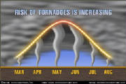
FEATURED THIS SEVERE WEATHER SEASON 2005 *STORM ALERT SOFTWARE*
 
MKRISCH.COM is a proud user of both InterWarn and StormLab Professional Software and is proud to partner up with Storm Alert Inc. to advirtise the best weather software on the web to all weather nuts!  They are awesome enough to give any user a 2-3 week Free-Trial (3 weeks on InterWarn and 2 weeks on StormLab Standard) for each software. If you decide to purchase it, in which i recommend to buy it, a low one time cost per software  will out do any other software on the market giving you weather information at your finger tips 24/7/365.
Both StormLab and InterWarn are for those weather novice spotters and chasers who would like to keep up to the minute as there issued statements and advisories and every single Dopplar Radar pics. that the NWS looks at, at the same time they are at your finger tips in one location, not several. You can save lots of $$$ if you purchase both, depending on what level of StormLab you prefer, best offer is StormLab Pro, for only a low one time cost.
If you have any question about either product please e-mail me at Tornado9017@yahoo.com or at Storm Alerts contact page.
 
Happy Tornado/Severe Weather Hunting,
 
Michael Krisch
Webmaster

titl.jpg
  
Please click on Storm Alert Inc. picture to be linked to the Severe Weather Software page for a 21 day free- trial on InterWarn and a 14 day free- trial for StormLab Standard. Pay only a one time cost for each software and unlimited free upgrades for each software bought and never pay a subscrption fee again for the best ever weather software. InterWarn ($44.95 Download or $54.95 for CD), StormLab Standard ($99.95 Download or $109.95 for CD), and/or StormLab Professional* ($179.95 Download or $189.95 for CD). *Best Value and choice.

CURRENT WEATHER ON THE SURFACE

US Current Weather

CLICK HERE TO VISIT SEVERE WEATHER CENTER 2005!

ACCUWEATHER TOP WEATHER HEADLINE
 

Krisch's SEVERE WEATHER CENTER 2005

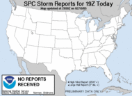
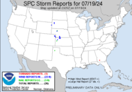
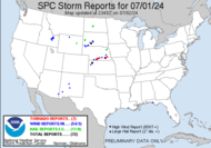
CURRENT SEVERE WEATHER ALERTS
 
US Severe Weather Alerts.

SPC Mesoscale Analysis

sector4


Lightning Data (updated every 30 minutes)


Latest World Weather and U.S Weather News
(provided by Weathermatrix.net)
 

Collage depicting fish, ships, satellites, ocean, maps, buoys, sun, hurricanes -- with the NOAA Logo
banner - top story

NOAA image of a huge solar flare being unleashed from the surface of the sun.NOAA LAUNCHES SPACE WEATHER WEEK 2005
Space weather forecasters and researchers, as well as industry analysts affected by space weather from around the globe, will converge in Colorado for the launch of this year's Space Weather Week. The four-day conference runs April 5-8 in Broomfield, Colo. "Space weather affects us all," said retired Navy Vice Adm. Conrad C. Lautenbacher, Ph.D., undersecretary of commerce for oceans and atmosphere and NOAA administrator. "Space weather affects people living and equipment in space as well as those on Earth. A unique and valuable aspect of Space Weather Week is the merging of research and operations."

Full Story Inside

banner - other news
NOAA image of carbon cycle greenhouse gases monitoring programs around the world. AFTER TWO LARGE ANNUAL GAINS, RATE OF ATMOSPHERIC CO2 INCREASE RETURNS TO AVERAGE, NOAA REPORTS — A spike in the amount of carbon dioxide released into the atmosphere between 2001 and 2003 appears to be a temporary phenomenon and apparently does not indicate a quickening build-up of the gas in the atmosphere, according to an analysis by NOAA climate experts. Carbon dioxide (CO2) is released into the atmosphere by the burning of wood, coal, oil and gas.
 
NOAA image of the Indian Ocean earthquake epicenter that occurred March 28, 2005. NOAA EMPHASIZES NEED FOR GLOBAL TSUNAMI WARNING SYSTEM — News of a major undersea earthquake in Indonesia resonated across the globe on Monday. Fortunately a destructive tsunami did not follow, unlike the previous strong earthquake that occurred only three months ago. Steps taken since the December 26 disaster allowed for a better exchange of information between NOAA and countries under the threat of a potential tsunami, but many hours of waiting for confirmation highlights the need for a more robust tsunami detection system.


NOAA image of drought monitor as of March 15, 2005. NOAA ISSUES 2005 SPRING OUTLOOK; Southwestern Drought Eases While Pacific Northwest Snowpack Levels Remain Low — NOAA unveiled the 2005 U.S. Spring Outlook for April through June. Of significance, one of the wettest winters on record has resulted in major reductions in the area and severity of drought in the Southwest and the Colorado River Basin—the first time this has occurred in five years.

Current Conditions

*U. S. Severe Weather Season 2005 Column*

 
.

Tornado Pictures of the Week!

2267516.jpg
Funnel cloud in Pittsburgh, Pa in 2003

*Tornadoes of the Week*
2267517.jpg
Another picture of the funnel cloud in Pittsburgh, PA in 2003

Active Tornado Months

Severe Weather Season
iws5.jpg
U.S. Tornado Frequency

ACCUWEATHER WEATHER HEADLINES

.

Storm Prediction Center Forecasts
 

Current Weather Watches

Valid SPC Convective Watches graphic and text


Current Mesoscale Discussions
Valid Mesoscale Discussion graphics and text


Current Convective Outlooks

       Today's Outlook
 
Current Day 1 Convective Outlook graphic and text

     Tomorrow's Outlook

Current Day 2 Convective Outlook graphic and text


        Day 3 Outlook

Current Day 3 Convective Outlook graphic
and text
 

Storm Reports
*Todays Reports for the Past Hour.
Today's storm reports received in the past hour

*Todays Storm Reports

Today's storm reports


*Yesterdays Storm Reports

 
Yesterday's storm reports

Weather Pictures
of the Week

jun.jpg
Spectacular Mammatus clouds loom overhead as the storm comes to a close in Andover, Minnesota. Photo

oct.jpg
This photo is of a supercell and beaver tail in Hays, Kansas. Photo ©2004 Ron Gravelle.

*All products brought to to by the following websites and please visit these sites for further details on any particular product. Please thank NOAA, NWS, SPC, Accuweather, Weathermatrix, TWC, TOA, WRAL.com. Please click on any link below to visit any of these websites to learn more.
 
National Oceanic Atmospheric Adm.- www.noaa.gov
National Weather Service - www.nws.noaa.gov
Storm Prediction Center - www.spc.noaa.gov
Accuweather - www.accuweather.com
Weathermatrix - www.weathermatrix.net
The Weather Channel - www.weather.com
WRAL News and Weather (Raliegh, NC) - www.wral.com
STORM ALERT INC. - www.interwarn.com

*Website Last Updated at 12:00am on April 6, 2005*